
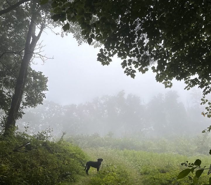
Our never ending road trip continued as Jaden, the dogs and I loaded up the Prius, said goodbye to the Virginia mountain fog and hello to the winding backroads of West Virginia. Nestled in the heart of the Blue Ridge Mountains, West Virginia is home to steep ravines, treacherous roads, and thin, narrow valleys surrounded by green mountains.
Driving through West Virginia feels a bit like going back in time. Old, decaying trailers are tucked in the forest with goats roaming the front yard. Abandoned brick houses are concealed with overgrown ivy.
“Highways” are steep, two lane roads with pot holes. Once the sun set, there were no street lamps or any fancy electronic signs. We could see the Milky Way from the front seat.
It may surprise you Westerners to learn that West Virginia takes the cake for being the most mountainous state in the contiguous U.S. While Colorado has the highest average elevation of any state and contains many of the highest peaks in the U.S., it also has extensive flat areas, making its percentage of mountainous terrain lower. West Virginia has the highest proportion of its land classified as mountainous compared to any other state, and coming off those peaks is 32,260 miles of rivers.
Despite the occasional Confederate flag displayed on dilapidated wooden porches, West Virginia separated from Virginia in the Civil War when Virginia chose to join the Confederacy. Due to West Virginia’s location in the rugged rural mountains, farmers were mostly self-sufficient and not reliant on slave labor like most of eastern Virginia, so they fought with the Union.
I always want to linger longer than I do in West Virginia, but 1,200 miles stretched out between us and our destination so we kept on driving. We found a free campsite in bumfuck Ohio in a state forest under a green canopy of buckeye, oak, maple, ash and pine. I’ve never felt the need to linger in Ohio, so we woke up early, packed up the tent and drove the remaining seven hours into new territory.
I get a thrill writing the word new.
After a decade of driving back and forth across the country, I finally visited two new states on this trip: Michigan and Wisconsin. I may have dipped into Michigan on the highway a few summers back, but I don’t like to count the state as visited unless I form a memory there.

What would have been my first trip to Wisconsin and Michigan got canceled back in 2023, when my late-partner Ian and I planned a 630 mile bikepacking route around Lake Superior. The route started on Minnesota’s North Shore, where we would ferry across Lake Superior to Isle Royale National Park to Michigan’s Upper Peninsula, then we’d follow the shoreline south through Wisconsin.
I was so excited to cross my first new state lines by bicycle. But September is a tricky time up north, and we arrived two days after the ferry to Michigan shut down for the season. Our bike trip was canceled, but we still squeezed in a misadventure on Isle Royale, which you can read about here.
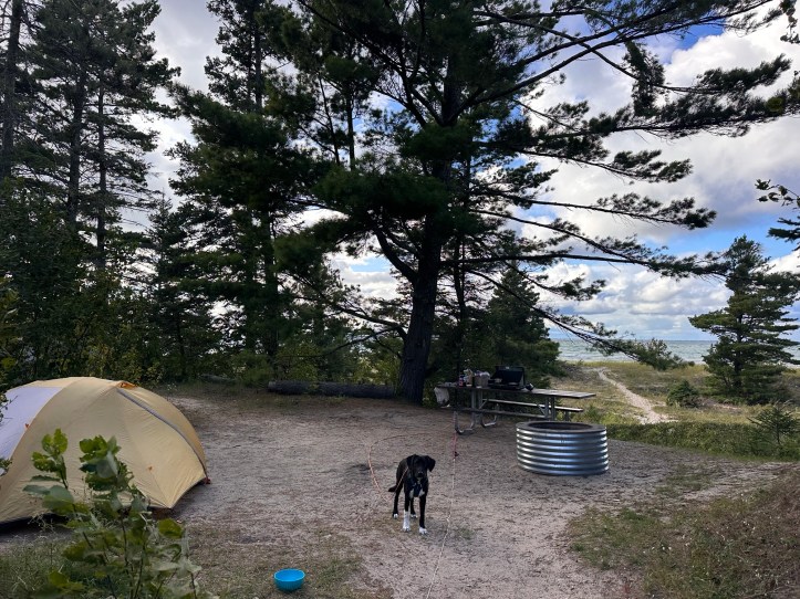
I’m not one to usually pay for campsites. I despise being charged to sleep on the ground in a suburban like environment next to strangers with all my own camping supplies. I prefer shitting in the woods to a communal campground pit toilet if it means I won’t see anyone for days on end. But I have a fascination with the Great Lakes, so I coughed up the absurd $35 to camp with a view of “Lake” Michigan.
I say “lake” because it resembles an ocean, with a succession of crashing waves on the sandy shore. The water itself seems impossibly endless, stretching out to touch the horizon, blurring the lines between sky and water.
As a writer, the most anticipated part of a great campsite is the view from the picnic table. It needs to be the kind of picnic table I can sit at for hours and pause with my pen hoovering over my journal to gaze out into an expanse view.
This particular site was underneath the shade of a swaying hemlock, its droopy branches bobbing up and down in a rhythmic trance. The long anticipated picnic table was alarmingly close to our neighbors, who were shouting over the wind at each other as they tried setting up their gigantic 10 person tent.

Some campgrounds bolt their picnic table into the ground, another thing I despise. This one wasn’t chained to a tree or bolted in, this was a free picnic table that I promptly dragged to the opposite side of our site so it could have a view of the white curling waves of Lake Michigan.
Two bald eagles soared above me as I set up the stove for dinner, riding the wind currents to linger above the shoreline with their wings fully expanded.
Our alarms were set for 5:15 a.m. the next morning to beat the bridge closure. Each year, the Mackinaw Bridge closes for one day to allow walkers to cross the bridge. Of course that happened to be the day we wanted to drive across. We decided to wake up and pack up camp before the bridge closed rather than waiting until the afternoon for it to reopen since we had a seven hour drive ahead of us to get to a friend’s house in Wisconsin.
Mackinaw Bridge is five miles long and stretches across the water of Lake Michigan and Huron, which I realized while driving over the bridge, are not separate lakes. They are hydrologically connected, but recognized culturally as two lakes.
Combined, Lake Michigan-Huron is the largest freshwater lake in the world!
We drove over the suspension bridge a few minutes before the sun rose, planning our day on the Upper Peninsula to be a stop and get out of the car day. On my phone, I located several waterfalls to see, plus a thrift store stop for some warmer clothes.
Days later, we learned that it was not Labor Day when we drove over the Mackinaw Bridge, and the closure actually happened a week after we crossed. Driving for multiple months distorts time.

Walking in the Northwoods feels cozy. We followed squishy dirt paths that wound through tall, dripping ferns and peeling paper birch trunks. Asters bloomed under the maples, chokecherries and pines which cast a dark, shaded canopy. Creeks merged into rivers and cascaded down ancient granite with grace.
The Wisconsin backwoods are a calm, sparsely populated region with big sweeping views of Lake Superior that appear through the pines and if you don’t look close enough you might think it’s just the sky.
The end of summer was holding on, but single maple leaves turning red signaled the coming of fall. Clouds crept in to block the sun with a breeze that whispered, “Put on a flannel.”
Our friend lives in an off grid cabin in the woods of Wisconsin with canoes and no electricity or running water. She burns her trash and knows the gas station attendant by first name, who lets her keep a tab when she forgets her wallet. She has dreams of building platforms for canvas tents on her five acres, which will officially become hers in November when she pays off her loan.
We set up our tent in her yard while the dogs ran in circles around her wooden cabin, weaving through the ferns and splashing in her canoe full of rain water. She gave us some cheese curds and a hat that said Keep it Corny, then we sat around the campfire giggling all night.
A slow, much needed, moment of peace during a long road trip across the country.

